...WINTER WEATHER TO BRING TRAVEL IMPACTS...
A low pressure system tracking over the area will bring a round of accumulating snow late Friday afternoon into Saturday. Friday night we could see some sleet mainly along the state border. Also watching for some freezing rain to mix it which could cause a light glaze on surfaces. Total snow amounts of 3 to 6 inches will be possible with the chance for some locally higher amounts in east central Wisconsin.
208 PM CST Thu Jan 16 2020
...WINTER WEATHER ADVISORY IN EFFECT FROM 5 PM FRIDAY TO 6 PM CST SATURDAY...
* WHAT...Mainly snow expected with some sleet. Total snow accumulations of 3 to 6 inches with locally higher amounts possible in east central Wisconsin due to lake enhancement. Slight chance for a light glaze of ice. Winds gusting as high as 35 mph.
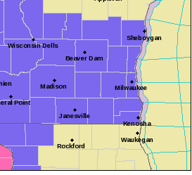
* WHERE...All of east central and southeast Wisconsin.
* WHEN...From 5 PM Friday to 6 PM CST Saturday.
* IMPACTS...Plan on slippery road conditions and reduced visibilities. The hazardous conditions could impact the evening commute.
PRECAUTIONARY/PREPAREDNESS ACTIONS... Slow down and use caution while traveling. The latest road conditions for the state you are calling from can be obtained by calling 5 1 1.
-0-