
NWS 3-12-2026 3p
Here's an update regarding the snow showers and high winds Friday, as well as the potential for a major winter storm Saturday night through Monday.
Bottom Line Up Front: Friday Morning to Friday Evening
- A strong cold front will sweep through the region early Friday morning, bringing locally intense snow showers.
- Quickly reduced visibility, increasing winds, and quickly dropping temperatures will allow for accumulations on elevated/untreated surfaces.
- Less than an inch of accumulations, but may still produce impacts to the morning commute.
- Winds will continue to increase as snow showers move eastward.
- Gusts 40-45 MPH before daybreak.
- Widespread wind gusts of 50 to 60 MPH from daybreak through 4 PM CDT.
Bottom Line Up Front: Saturday Evening into Monday
- A long-duration winter weather event remains forecast across southern Wisconsin
- Based on current forecasts for system track & temperatures, we're watching for two "phases" of precipitation in this system:
- Phase 1: Saturday Evening through Sunday
- Mixed precipitation (snow, sleet, freezing rain, and rain) moves across the area
- Generally speaking: precipitation remains all snow across the far north, changes over to all rain near the WI-IL border, with a transition zone of sleet and freezing rain in between
- Phase 2: Sunday Evening through Monday
- Transition to moderate-heavy snow occurs over all of southern Wisconsin
- Moderate to heavy snow combines with very gusty winds to create substantial blowing snow and greatly reduced visibilities to as low as 1/4 mile
- Phase 1: Saturday Evening through Sunday
- Most significant snow accumulation is currently expected across far northern parts of the area, with potential ice and sleet accumulation eating into snow accumulations further south
- Given a mix of potential precipitation types & the possibility for significant heavy snow and blowing snow impacts, treacherous travel conditions are expected Saturday night into Monday
- These impacts could extend into or through the Monday morning commute if current timing forecasts stay on track
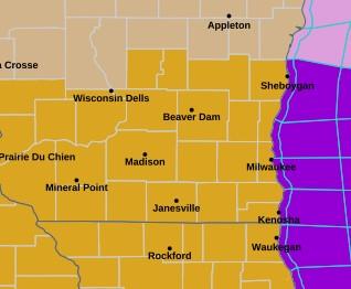
- A Winter Storm Watch is now in effect between 7 PM Saturday and 4 PM Monday
- Decisions regarding warnings versus advisories will be made over the next 24 hours
- This is an evolving forecast - continue to stay tuned for additional updates through Saturday afternoon
What has changed?
- Quick-moving snow showers may rapidly drop visibility and lead to quick accumulations on untreated surfaces as winds increase Fri. morning.
- A High Wind Warning has been issued for 4 AM Fri. to 4 PM Fri.
- A Winter Storm Watch has been issued Saturday night through Monday afternoon as the potential for a significant winter storm continues to increase this weekend
-0-
--