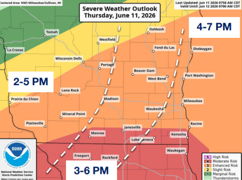

June 11, 2026 2:30p
* Tornado Watch for portions of Southern and Eastern Iowa, Northern and Central Illinois, Northwest Indiana, Northern Missouri, Southern Wisconsin and Lake Michigan
* Effective this Thursday afternoon and evening from 155 PM until
900 PM CDT.
* Primary threats include...
Several tornadoes and a couple intense tornadoes likely...Widespread damaging winds and isolated significant gusts to 80 mph likely...Scattered large hail and isolated very large hail events to 2.5
inches in diameter possible.
SUMMARY...A complex scenario remains apparent this afternoon across the Midwest. Any supercells which can become surface based will pose a threat for strong tornadoes and large to very large hail given a rather favorable environment. The threat for widespread severe/damaging winds will increase through the afternoon/evening as
thunderstorms likely grow upscale into an intense bowing cluster.
Peak gusts may reach up to 70-80 mph.
REMEMBER...A Tornado Watch means conditions are favorable for
tornadoes and severe thunderstorms in and close to the watch
area. Persons in these areas should be on the lookout for
threatening weather conditions and listen for later statements
and possible warnings.
-0-