Apr. 14, 2026 8:50a; Updated at 12:30p; 3p
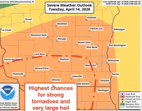
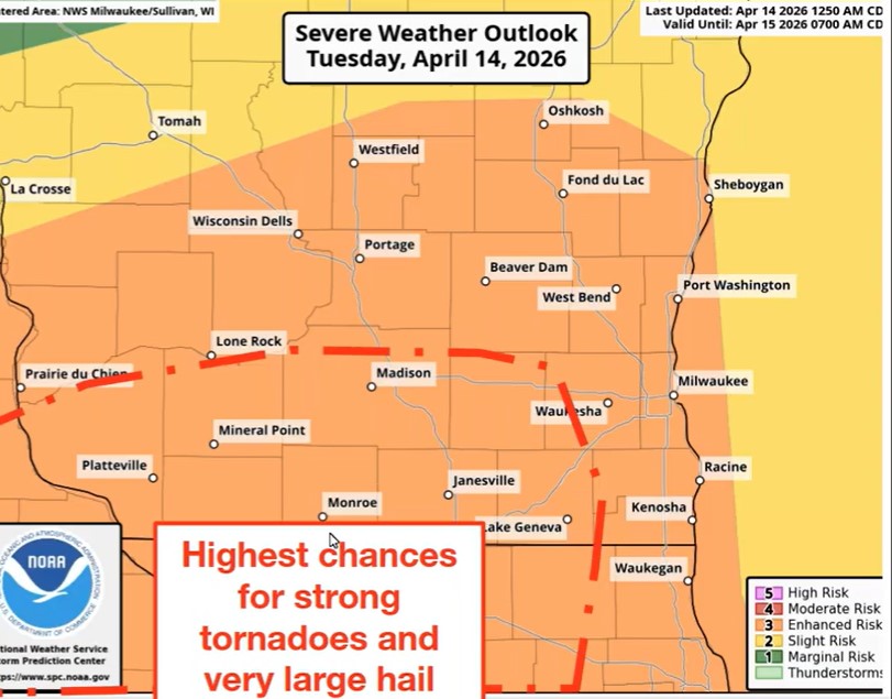
(WGTD)---The National Weather Service says another round of severe weather is expected today across southern Wisconsin, including the WGTD listening area.
This activity could be a bit more widespread and more severe than what moved through Monday night and early Tuesday morning.
Long-track tornadoes, very large hail and heavy downpours are all possible, with peak activity occurring before midnight. "This is a fairly rare setup for us with the potential for these higher end severe types," said NWS in a mid-afternoon post.
A Tornado Watch is in effect until 10p.
Storms moved through southeast Wisconsin in the early morning hours of Tuesday, triggering numerous thunderstorm and tornado warnings, including a tornado warning that covered all of Racine County for a time. While rotation was indicated on the radar numerous times overnight, there were no reports of any touchdowns, save for a tornado north of Eau Claire.
Winds due to the storms overnight were in the 60 to 70 miles per hour range. Numerous trees and branches were down along with a report of a half-dozen utility poles being damaged at a location west of the interstate in Racine County.
A couple hundred We Energies customers in Racine and Kenosha counties were without power at daybreak. The number in Walworth County was around 2,400.
-0-