|
Tornado Watch Number 129
NWS Storm Prediction Center Norman OK
1240 PM CDT Fri Apr 17 2026
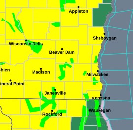
The NWS Storm Prediction Center has issued a Tornado Watch for portions of Central and Eastern Iowa, Northern and West-Central Illinois, Southeast Minnesota, far Northeast Missouri and Central and Southern Wisconsin
* Effective this Friday afternoon and evening from 1240 PM until 800 PM CDT.
* Primary threats include... A few tornadoes likely with a couple intense tornadoes possible widespread large hail and isolated very large hail events to 3.5 inches in diameter likely. Scattered damaging wind gusts to 70 mph likely
SUMMARY...A very moist and unstable airmass exists ahead of a cold
front progressing eastward/southeastward across the region. Thunderstorm development is anticipated within the warm sector ahead
of the front, where discrete supercells capable of all severe hazards, including very large hail and strong to intense tornadoes are possible. Thunderstorm development is possible along the front as well, with large hail and strong gusts the primary risk with these storms.
REMEMBER...A Tornado Watch means conditions are favorable for
tornadoes and severe thunderstorms in and close to the watch
area. Persons in these areas should be on the lookout for
threatening weather conditions and listen for later statements
and possible warnings.
-0-
|