
...FLOOD WATCH REMAINS IN EFFECT THROUGH THURSDAY MORNING...
* WHAT...Areal flooding and flash flooding caused by excessive
rainfall from thunderstorms is possible.
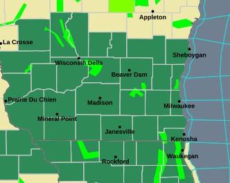
* WHERE...Portions of east central, south central, and southeast
Wisconsin, including the following counties, in east central
Wisconsin, Fond du Lac and Sheboygan. In south central Wisconsin,
Columbia, Dane, Green, Green Lake, Iowa, Lafayette, Marquette,
Rock and Sauk. In southeast Wisconsin, Dodge, Jefferson, Kenosha,
Milwaukee, Ozaukee, Racine, Walworth, Washington and Waukesha.
* WHEN...Through Thursday morning.
* IMPACTS...Excessive runoff and ponding of water may result in
flooding of rivers, creeks, streams, and other low-lying and
flood-prone locations. Creeks and streams may rise out of their
banks.
* ADDITIONAL DETAILS...
- An additional 1 to 2 inches of rain may fall tonight with expected heavy rain from thunderstorms. This will cause additional chances for flash flooding, rises on creeks and streams, and will exacerbate river flooding over southern
Wisconsin.
-0-